For “Travel Tuesday”, Let’s visit The Davis Mountains in
“Big Bend Country. Named for the Big Bend National Park, the westernmost region of Texas boasts pristine parklands, wide open skies, popular hiking and camping areas, and the beautiful Davis Mountains. Relive the days of the Wild West or experience the international culture of old El Paso. Discover the Park Lands of the Texas Big Bend Country.”
“Slowly, a purple mass begins to fill the southwestern horizon, like an island lost in a desert sea the Davis Mountains rise up into a cerulean blue sky.
A unique oasis in the vastness of the Trans-Pecos, the Davis Mountains are Texas' best kept secret. Anyone who has driven the scenic loop from Fort Davis through the mountains can be excused for doubting that they are really in Texas. The topography, flora, and fauna are, in general, more reminiscent of New Mexico, Arizona or Colorado than of the state in which they are located.
Formed from Cenozoic Era volcanoes, the Davis Mountains were built up over a period of several million years and are radically different from the limestone plateaus and mountains that surround them. After 35 million years of erosion all that remains are the resistant igneous masses from the central region located between the two great calderas that gave birth to these mountains.
Isolated by the surrounding desert, the mountains form a "sky island" with a unique biota unlike anything else to be found in Texas. With altitudes ranging from 3,500 to 8,000ft, this region is possessed of a mild climate that escapes the intense heat and humidity that characterizes so much of the State of Texas in July and August. The rich volcanic soils support vast grasslands in the lower foothills culminating in Texas' most extensive montane forests in the higher elevations.
Nestled in the middle of all this beauty is the town of Fort Davis, county seat and largest city. For a small town Fort Davis packs in a great deal of character and personality. Boasting a national monument, state park, major research centers, and an artistic community, Fort Davis earns the title of the "best little town in Texas"! It is certainly the highest at 5050ft.
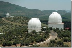
The surrounding area is a tourist mecca filled with interesting places to visit. Among these are included the McDonald Observatory, Chihuahuan Desert Research Institute, and the Prude Guest Ranch just to mention a few. From the summit of Mount Livermore to the quiet streets of Fort Davis, the Davis Mountains represent some of the very best that Texas has to offer.
Mount Livermore
Snowfall on Limpia Creek
Fall color on Skyline Ridge
Today, scarcely a hundred years after the first Anglo-American settlement of the mountains, the region is facing a new set of problems. The Nature Conservancy and other groups are working hard to prevent the over development of this fragile environment, a development that could destroy the historical foundations of the region and mar the very qualities that make the Davis Mountains so attractive. Hopefully a sustainable compromise can be reached and this region will continue to occupy that special place it has carved out for itself in Texas.” More at: http://www.davis-mountains.com/pages/Davis%20Mountains/davis02.html
_______
Davis Mountains Preserve, Texas
“The wild and remote Davis Mountains is considered one of the most scenic areas of Texas. Indeed it is one of the most biologically diverse. Rising above the Chihuahuan desert, the range forms a unique “sky island” surrounded by the lowland desert. Animals and plants living above 5,000 feet are isolated from other similar mountain ranges by vast distances. These are true ecological islands, preserving living remnants that occur otherwise nowhere else in Texas.
The 33,000-acre Davis Mountains Preserve (with conservation easements on 65,830 acres of adjoining property) includes Mount Livermore, the summit of the Davis Mountains. It encompasses the heart of a functioning landscape with intact watersheds and a unique assemblage of animals and plants.

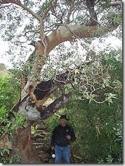
Plant life is diverse and presents interesting contrasts. On the wetter, shaded slopes is a montane forest, including ponderosa pine and small but thick stands of quaking aspens sheltered under a cliff beneath Mount Livermore.
 South-facing slopes are dominated by pinyon pine, gray oak, alligator juniper and mountain mahogany. Madrone trees dot the valleys and deep canyon streambeds. Eleven rare species of plant are known, including the Livermore sandwort, many-flowered unicorn plant and fringed paintbrush.
Mountain dwelling wild animals include the black bear and mountain lion. The group of birds in the higher elevations, including the common black-hawk, golden eagle, dusky-capped flycatcher, and Montezuma quail, is more closely associated with western mountain ranges than birds across the rest of Texas. Some  species nest here and nowhere else in Texas.
This system is also of importance for bird migration. Various birds of prey, ten species of hummingbirds and some of the other gems of America, including the painted redstart and Grace’s warbler, migrate through the Davis Mountains. In just a relatively short time we have found on the property Mexican spotted Owls and slate-throated redstarts, two very rare birds for Texas.
Why the Conservancy Selected This Site
The Davis Mountains comprise a unique and limited ecosystem. Adapted to natural processes of fire and drought, the system is slow to recover from impacts inflicted by humans. Overgrazing, habitat fragmentation through ranch subdivision and overuse of the water resources by a growing population are potential threats to one of Texas’ most ecologically diverse landscapes.
The Conservancy has known of the importance of preserving this natural area for some time. Three priorities guided us to action: the conservation of a landscape-scale “sky island”, the preservation of West Texas’ ranching legacy by keeping a large and historical part of that heritage intact, and safekeeping the dark skies surrounding University of Texas McDonald Observatory.
With the 32,000-acre purchase of part of the historic U Up U Down Ranch, the subsequent additions of other parcels and the donations of conservation easements on some 70,000 acres thus creating a buffer around the core preserve, roughly 100,000 acres of the Davis Mountains are under protection.
Water found in surface streams, springs or shallow ground-water tables is the lifeblood of this arid portion of the state. Conservation on the Davis Mountains Preserve and on neighboring lands is crucial to the protection of the hydrological system that originates at Tobe Gap and Bridge Gap on Mount Livermore, extends through rugged canyon lands and opens out into the desert flats near the town of Balmorhea.”
For information about visiting the preserve, contact Davis Mountains Preserve Manager, Shawn Benedict at shawn_benedict@tnc.org or (432) 480-6860.
Download Fact Sheets
Davis Mountains Project (PDF),
Chihuahuan Desert Ecoregion (PDF)
Davis Mountains Preserve © Lynn McBride
Field Trips and Events
Davis Mountains Preserve 2013 Schedule of Events
July 12-14 - Open Weekend
Davis Mountains Open Preserve Weekend July 12 at 9:00am until July 14 at 5:00pm in CDT
August 16-18 - Open Weekend
October 19 - Open Day
December 7 & 14 - Open Day (Christmas Tree Hunts)
The Nature Conservancy’s Davis Mountains Preserve will be open for hiking, picnics, photography, birding and other outdoor activities on selected days this year.
The Davis Mountains Preserve is located approximately 25 miles northwest of Ft. Davis on Hwy. 118 (about 10 miles past McDonald Observatory & about ¼ mile past the Lawrence E. Wood Picnic Area). Guests will be required to sign in and out at the McIvor Conservation Center.
Interested parties are reminded that the Madera Canyon Trail, also located in the Davis Mountains Preserve, adjacent to the Lawrence E. Wood Picnic Area, is open to the public year-round from dawn until dusk.
For more information, contact Davis Mountains Preserve Manager Shawn Benedict at shawn_benedict@tnc.org or (480) 458-6860. To learn more about the Davis Mountains Preserve and other Texas lands The Nature Conservancy works to protect, visit www.nature.org/texas.
_______
Into the Wild: Madera Canyon Trail
“Determined to take a West Texas walk one particularly blustery spring day, my son and I blew into Fort Davis. Almost literally. A warm tail wind out of Marfa swept us up into the desert frontier town—at an altitude of 5,050 feet, the highest town in Texas. The former cavalry outpost (the fort was active from 1854-1891) usually boasts a pleasant Denver-without-snow climate, but when La Niña blasts, she gets your full attention. Grit in the teeth aside, altitude and climate make the surrounding Davis Mountains a favorite among hikers and bikers. On the other hand, rugged terrain and private land holdings mean that the most extensive mountain range in the state has only limited public access.
My 10-year-old and I had already hiked the trail between the old fort and Davis Mountains State Park (fabulous views) and declared the Chihuahuan Desert Research Institute’s trails a flora fiend’s delight. This trip I’d promised Elliott he’d be one of the first to goat-leg it up the Nature Conservancy’s newly opened Madera Canyon Trail—a little thing like gusting 50-mph wind isn’t going to stop him. (In the spirit of full disclosure, trail’s-end enticements include root-beer floats at the Ft. Davis Drugstore’s famed soda fountain and a dip in the Hotel Limpia’s pool.)
We battle the wind past the Jeff Davis County Courthouse to the Nature Conservancy offices, where we meet Colin Shackelford, Stewardship Director of the Davis Mountains Preserve and our day’s companion. Hale and hearty despite a week of fighting wildfires, Shackelford is no stranger to hard work, but, he says, blazing a trail was new to him. Hired after the Madera Canyon Trail plans were in motion, Shackelford says his background in plant community ecology provided him “next to nothing” in the way of trail-building experience. For trail building, he relied on expert stonemasons (with technical rockwork experience) and direction from an expert on trail layout on loan from Big Bend National Park.
Shackelford’s team completed the task with almost 2,000 hours of volunteer labor, and Madera Canyon Trail—opened to the public in October 2007—is now ours for the tackling.
Leaving town, the hoodoos (vertical columns of basalt characteristic of the foothills) stand sentinel at The Fort Davis National Historic Site and mark our way as we wind up past Davis Mountains State Park (home to Indian Lodge, one of the state’s most unusual historic hotels). Heritage cow-calf operations still predominate the landscape, although increasing numbers of weekend and retirement cabins dot the mountainsides. Still, Fort Davis remains a soothing settlement of 1,050 souls. It’s isolated enough that a big grocery-shopping trip involves a couple of ice chests and a two-hour drive to Midland.
Sixteen miles northwest of Fort Davis, we pass the turn-off to Mount Locke (altitude 6,800 feet) and the McDonald Observatory, the third-largest observatory in the United States (the visitor’s center and scheduled star parties are not to be missed).
We see ponderosa pine in protected draws as we climb past a better-thighs-than-mine bicyclist laboring against the wind and elevation at Elbow Canyon. Beyond him, Pine Peak points into Big Sky blue; at 7,900 feet, it’s second only to Mt. Livermore, which tops out at 8,382 feet. All around us, the aptly named stands of scaly alligator juniper and piñon pine appear. Above us the elusive Southwest-ern white pine comes into view.
Crossing Madera Creek at the old Fisher Ranch, we soon turn in at the Lawrence E. Wood picnic area, acclaimed as the highest roadside park in Texas, its meadowland appeal picnic-perfect. Unbelievably, given that our visit heralds the beginning of Spring Break, the park (which is also the trailhead for the Madera Canyon Trail) is empty. As soon as he can dodge my slathering of sunblock, Elliott makes a slippery escape, visions of black-chinned hummingbirds and acorn woodpeckers calling him.
Shackelford, despite a sleepless week and a twisted ankle, is an enthusiastic hiking companion who offers a naturalist’s insights as we climb.
Strolling and jabbering, we discuss how the Davis Mountains form a “sky island” where animals and plants living above 5,000 feet are isolated from other mountain ranges by distance.
The Nature Conservancy’s Davis Mountain Preserve covers a big chunk of land, but much of it is inaccessible to the public except by prior arrangement or for special events. The Madera Canyon Trail, open to the public 365 days a year, is a fantastic entrée to vistas, fauna, and wildlife not easily seen elsewhere. While the trail offers a decent 2.4-mile loop of length, the 175-foot rise in elevation (to 6,050 feet) means it is doable, even in today’s desiccating wind. The gentle elevation is only moderately difficult, and much of the path is more like a stroll in a rough-hewn garden. When the slight climb opens up to the highland vistas, the views are jaw-droppingly beautiful.” From: http://www.texashighways.com/index.php/component/content/article/34-panhandle-plains/5872-into-the-wild-madera-canyon-trail By Barbara Rodriguez From the February 2009 issue.
---------
Hike Thru Madera Canyon
“We spent a week in Fort Davis Texas. One afternoon while driving down the Scenic Highway, Texas 166, we stumbled across the Madera Canyon Nature Trail. We only walked part of the trail since we had a couple of whiners in the car with us. Be that as it may, it is a beautiful spot to hike and enjoy the outdoors.”
_____
Fort Davis, Texas, Escape to the Mountains
Fort Davis National Historic Site
“Nestled in the heart of the Davis Mountains of West Texas, Fort Davis is a place of majestic beauty, where wildlife abounds among the high desert vastness.
Named a 2008 Dozen Distinctive Destination®, by the National Trust for Historic Preservation®, history and culture are apparent throughout the community and opportunities to learn and explore await you. Fort Davis National Historic Site, which is one of the best restored military forts in the southwest, helps explain the historic significance of this small town.
A visit to McDonald Observatory gives you the chance to look through telescopes and view celestial bodies in one of the darkest night skies in the United States. From here one can see the Milky Way with the naked eye. The scenery from Davis Mountain State Park or the Nature Preserve is one that you must see to believe. With so many choices of places to hike, ride bicycles, horses, motorcycles, walk or drive you will find Fort Davis to be an unforgettable experience.
Although there aren't that many folks in this mile high community, the people you will meet are friendly and helpful. A local broom maker crafts 1800's style brooms, and other unique shops embellish the downtown area. Fort Davis boasts the oldest Inn in West Texas along with many other charming places to stay. The quaintness of Fort Davis will take you back in time.
Due to its low humidity and a mild climate, Fort Davis is a great place to visit year round. There are no traffic lights, no chain stores, and no shopping malls. In fact, Fort Davis is just one mile long. Here you can find tranquility along with the chance to learn about the many different facets of this mountainous region including rare species of wildlife, distinct rock formations and exceptional plant life.
Fort Davis, Texas...Experience Life!”
--------
A Frontier Post
“From 1854 to 1891, Fort Davis was strategically located to protect emigrants, mail coaches, and freight wagons on the Trans-Pecos portion of the San Antonio-El Paso Road and on the Chihuahua Trail, and travelers hoping to reach the gold fields of California. Fort Davis is one of the best surviving examples of an Indian Wars' frontier military post in the Southwest.
More at: http://www.nps.gov/foda/fortdavisfrontierpost.htm
______
McDonald Observatory, Fort Davis
 “Texas’ wide open spaces don’t stop at the horizon — the skies over the Davis Mountains are some of the starriest in the state. On Tuesday, Friday and Saturday evenings, visit the McDonald Observatory for one of its legendary Star Parties. Simply looking up with the unaided eye or looking through one of the observatory’s massive telescopes, learn about the constellations, planets and other bright lights overhead. On any given night, the guest list might include celebs like the rings of Saturn, the moons of Jupiter or the dusty tail of a comet. These parties are never dull and are always well-attended.” mcdonaldobservatory.org
______
On This Day:
Congress passes the 19th Amendment, Jun 4, 1919:
“The 19th Amendment to the U.S. Constitution, guaranteeing women the right to vote, is passed by Congress and sent to the states for ratification.
By the beginning of the 20th century, the role of women in American society was changing drastically; women were working more, receiving a better education, bearing fewer children, and several states had authorized female suffrage. In 1913, the National Woman's party organized the voting power of these enfranchised women to elect congressional representatives who supported woman suffrage, and by 1916 both the Democratic and Republican parties openly endorsed female enfranchisement. In 1919, the 19th Amendment, which stated that "the rights of citizens of the United States to vote shall not be denied or abridged by the United States or by any State on account of sex," passed both houses of Congress and was sent to the states for ratification. On August 18, 1920, Tennessee became the 36th state to ratify the amendment, giving it the two-thirds majority of state ratification necessary to make it the law of the land. Eight days later, the 19th Amendment took effect.”
______
Dunkirk evacuation ends, Jun 4, 1940:
“On June 4, 1940, the evacuation of Allied forces from Dunkirk on the Belgian coast ends as German forces capture the beach port. The nine-day evacuation, the largest of its kind in history and an unexpected success, saved 338,000 Allied troops from capture by the Nazis.
As there were not enough ships to transport the huge masses of men stranded at Dunkirk, the British Admiralty called on all British citizens in possession of sea-worthy vessels to lend their ships to the effort. Fishing boats, pleasure yachts, lifeboats, and other civilian ships raced to Dunkirk, braving mines, bombs, and torpedoes.
The harbor at Dunkirk was bombed out of use, and the small civilian vessels had to ferry the soldiers from the beaches to the warships waiting at sea. But for nine days, the evacuation continued, a miracle to the Allied commanders who had expected disaster. By June 4, when the Germans closed in and the operation came to an end, 198,000 British and 140,000 French troops were saved.”
______
Battle of Midway begins, Jun 4, 1942:
“On this day in 1942, the Battle of Midway--one of the most decisive U.S. victories against Japan during World War II--begins. During the four-day sea-and-air battle, the outnumbered U.S. Pacific Fleet succeeded in destroying four Japanese aircraft carriers while losing only one of its own, the Yorktown, to the previously invincible Japanese navy.”
______
Yesterday:
My appointment at the doctors was for 9.30.AM. All I had was black coffee, so they could do blood work.
Even though I arrived there at 9.20, I didn’t get out of there until 11.30.AM. It seems that if you go as a ‘walk-in’ or have an appointment, it takes the same amount of time. But this time I was seeing the doctor who is listed as my Primary Care Physician, who I had never even met.
After leaving me in an exam room for ages, the lady doctor examined me and said that my sinus problems are an allergy. She prescribed nose drops, eye drops, an inhaler, and wants to see me again in a month. Then she sent me to the vampires, who had trouble getting 5 vials of blood out of my arm. My old body only wanted to give up 4! Maybe the blood tests will tell her something. I stopped at Kroger’s Pharmacy, but the RX hadn’t even been called in yet. I wasn’t going to wait around for hours, so I came home.
In the afternoon I vacuumed the carpet with my upright that has a HEPA filter, but that doesn’t usually make a difference to my sinuses. The cats being gone has helped a bit, but I need to find out what I am allergic to.
Then just as I was getting used to being ‘cat-less’, Kenya called to say that Simba is not being nice at the Cat Habitat, and I might have to pick him up today.


2 comments:
We spent some time in the Davis Mountains last April. If you have been following my blog, I posted some pictures of the park and wild life. A beautiful place and when we left, we went north to I-10 and that was a very scenic drive. It was extremely high in the WOW factor!!
I am a bit late thanking you for your comment, DD, as I was going back over your blog from when you were in the Fort Davis Area.
I had been following you when you were there, but I you never mentioned going to the McDonald Observatory, so I wanted to check back and see.
That would have been one place that I wouldn't have thought that you would have missed??
Happy Tails and Trails, Penny
Post a Comment