
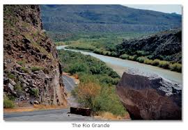
Why these two? Well, if you are on I-10, to get to Big Bend they are on the way.
VAN HORN, TX
"Van Horn, the county seat of Culberson County, is on the Missouri Pacific Railroad thirty-six miles west of Kent in southwestern Culberson County. The Van Horn Wells were reportedly discovered twelve miles south of the future townsite by Maj. Jefferson Van Horne, who became commander at Fort Bliss in El Paso in 1849, and were well known to nineteenth century travelers. The coaches of the San Antonio-El Paso Mail passed through the area in the late 1850s and early 1860s, when Lt. James Judson Van Horn, no relation to Major Van Horne, was in command of an army garrison at Van Horn Wells.
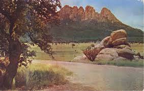
VAN HORN MOUNTAINS
The Van Horn Mountains begin nine miles southwest of Van Horn in southeastern Hudspeth County and stretch sixteen miles southeast, across southwestern Culberson County and into northwestern Jeff Davis County The highest elevation in the Van Horn Mountains is 5,565 feet above sea level. The surrounding rugged terrain is surfaced by shallow, stony soils that support post oak, live oak, piñon, juniper, chaparral, and grasses. The mountains, like the town of Van Horn, were named after Lt. James Judson Van Horn, who commanded a garrison at nearby Van Horn Wells from 1859 to 1861. The Van Horn Mountains have been fertile ground for minerals. The Hazel Mine, opened in 1856 by Thomas Owen or Owens, yielded over a million pounds of copper between 1891 to 1947 and more than two million ounces of silver over a similar period (see COPPER PRODUCTION, and SILVER MINING). When the price of silver rose in the early 1970s, exploration began near the old Plata Verde mine, but it ceased in the early 1980s when the price of silver dropped again. A mica quarry operated briefly in the Van Horns in the early 1980s.
VAN HORN CREEK
Van Horn Creek rises a mile southwest of Farm Road 2017 in the eastern Van Horn Mountains in western Jeff Davis County one mile southeast of the Culberson county line. The surrounding flat terrain has local shallow depressions and is surfaced by clay and sandy loams that support water-tolerant hardwoods, conifers, and grasses. Van Horn Creek, like the mountains in which it rises and the town of Van Horn, is named for James Judson Van Horn.
More at: http://www.tshaonline.org/handbook/search/results/Van%20Horn
__________
Fort Stockton Historical Tours
"Directional Signs have been erected to guide visitors around town to sixteen points of interest.
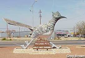
The tour begins at Paisano Pete at the intersection of Dickinson (Business I-10) and Main Street. Brochures with a map of the route are available from the Chamber of Commerce, Annie Riggs Museum, Historic Fort Stockton, and Grey Mule Saloon.
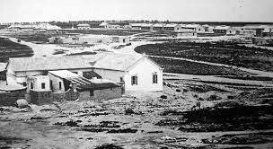
Fort Stockton in 1884
The tour signs are blue and white with a black arrow. Following the arrows, the visitor travels through the National Register Historic District and will see general mercantile stores, a saloon, two churches, even a house ordered from the Montgomery Ward Catalog. Not all of the buildings on the tour are open to the public. Several of the buildings now serve alternative uses either as offices or homes. The tour is just under two miles long.
Fort Stockton is a designated Main Street City and numerous downtown businesses take pride in refurbishing the store fronts along the historical tour. The Annie Riggs Museum, housed in a turn-of-the-century adobe hotel, provides insight into the region's history and development with exhibits in thirteen areas.
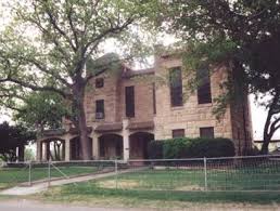
Former Jail, Fort Stockton
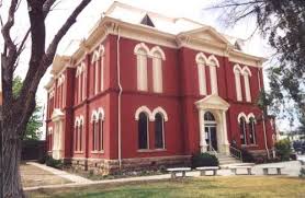
The tour travels past the 1912 Pecos County Courthouse (Fort Stockton is the county seat), the 1883 Jail, the oldest remaining school in town, the "Oldest House" and the Grey Mule Saloon. Also on the tour is one of the nine springs in the Comanche springs system, which once had a flow of 65 million gallons of water a day.
 The frontier army post includes three remaining quarters on Officers' Row on the grounds of Historic Fort Stockton.
Yes! Fort Stockton has a fort. The frontier army post, active from 1867-1886, includes three remaining Officers' Quarters, the Guardhouse, and Parade Grounds. Two Enlisted Men's Barracks and their Kitchens have been reconstructed, one of which houses the Fort Museum.
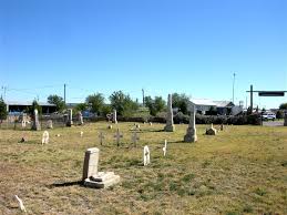
The tour ends at the Fort Cemetery. All the headstones are for civilians, as the military personnel and dependents were exhumed and moved to the National Cemetery in San Antonio in 1888.
Sheriff A.J. Royal's tombstone bears the inscription "assassinated", a testament to a violent period in our history."
____________
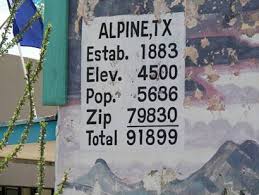
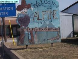
Alpine, TX. Another great area at the gateway to the Big Bend country, is scenic Alpine, TX, the county seat of Brewster County.
"Come see for yourself the beauty and the wonder of the place called the Last Frontier!"
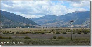
"Alpine is a gem. A remote, high-desert jewel nestled in the tall hills of West Texas. It is a friendly, bustling community of a little over 5,000 people in a scenic valley that feels like nowhere else in the state. You’ll immediately take note of the natural beauty surrounding the city, if you don’t notice the great weather first."
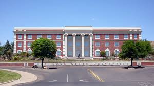
"In the heart of the beautiful mountains of West Texas, Alpine is the gateway for Big Bend National Park, Big Bend Ranch State Park, and the Davis Mountains. Nearby is the Ft. Davis National Historic Site, the McDonald Observatory, the Marfa Mystery Lights (seen on the TV show Unsolved Mysteries), the Chinati Foundation, and spectacular wildlife viewing! Alpine is also the home of Sul Ross State University, location of the Museum of Big Bend."
"Alpine is listed as one of the fifty safest and most economical places for retirement in the United States. It is often spoken of as the "heart of the Big Bend," the "Alps of Texas," "out where the West begins," and the "economic, cultural, and recreational center for Trans-Pecos Texas.""

"The region encompasses vast expanses of the Chihuahuan Desert, picturesque hills and mountains reaching more than 8,000 feet high, rolling plains, grasslands and a wide assortment of plants, wildlife and geological features which attract visitors from throughout the world."
"The climate is mild year-round and a perfect place to visit all year long. Summer has low humidity with light breezes and cool nights. Winter is also mild with lots of sunshine!"
----------
Everyone I know from Alpine, is ready to go back!
____________
On This Day:
The Great Brinks Robbery, Jan 17, 1950:
"A team of 11 thieves, in a precisely timed and choreographed strike, steals more than $2 million from the Brinks Armored Car depot in Boston, Massachusetts. The Great Brinks Robbery, as it quickly became known, was the almost perfect crime. Only days before the statute of limitations was set to expire on the crime, the culprits were finally caught.
Tony Pino, a lifelong criminal, was the mastermind behind the audacious theft. Together with Joe McGinnis, he assembled a group that meticulously planned the heist. They staked out the depot for a year and a half to figure out when it was holding the most money. Then, the gang stole the plans for the depot's alarm system and returned them before anyone noticed that they were missing.
The criminal team held repeated rehearsals, with each man wearing blue coats and Halloween masks. On January 17, they finally put their plan into action. Inside the counting room, the gang surprised the guards and tied up the employees. Multiple canvas bags, weighing more than half a ton, were filled with cash, coins, checks, and money orders. Within 30 minutes, the Brinks robbery team was gone--taking $2.7 million with them. They left no clues at all.
Next, the gang met and split the proceeds of the theft. They agreed that each would stay out of trouble for six years and they almost made it. However, one of the men, Specs O'Keefe, left his share with another member because he had to serve a prison sentence for another crime. O'Keefe, worried that he would be cheated out of his money, indicated that he might begin to talk. The others decided to send a hit man to kill O'Keefe but he was only wounded, and the assassin was caught. O'Keefe made a deal with police and testified against the others. Eight participants in the Great Brinks Robbery were caught and convicted. However, only a small part of the money was ever recovered."
_____________
Earthquake rocks Los Angeles, Jan 17, 1994:
"On this day in 1994, an earthquake rocks Los Angeles, California, killing 54 people and causing billions of dollars in damages. The Northridge quake (named after the San Fernando Valley community near the epicenter) was one of the most damaging in U.S. history.
It was 4:31 a.m. when the 6.7-magnitude quake struck the San Fernando Valley, a densely populated area of Los Angeles located 20 miles northeast of the city's downtown. With an epicenter 12 miles beneath the earth's surface, the earthquake caused the collapse of several apartment buildings. At the Northridge Meadows complex, 16 people died, all of whom lived on the first floor, when the weak stucco structure fell down on them as they slept.
Given the strength and location of the earthquake, it was fortunate that the death toll was not far higher. Two key factors were critical in reducing the casualties. First, the quake struck in the middle of the night while nearly everyone was at home in their beds. A mall parking lot in the Valley collapsed, but no one was killed because it was entirely empty. Several highways also suffered critical failures, but only one police officer died, when his vehicle plunged off an overpass. The other key factor was that the city's building and safety codes were strengthened following the 1971 Sylmar quake that collapsed the San Fernando Veterans Hospital. Every building constructed after the new regulations were implemented stayed intact.
Still, the quake caused a huge amount of property damage over a wide area, especially in the beach community of Santa Monica, even though it was relatively far from the epicenter. As much of Santa Monica stands on soil that is less solid than bedrock, it suffered severe ground movement during the earthquake. The partial collapse of the Santa Monica freeway snarled traffic in Los Angeles for months. All told, it is estimated that the earthquake was responsible for $20 billion in damages."
____________
Yesterday:
Even first thing in the morning it was warm, so the cats were out on the porch early, and the windows and doors were open.
I knew that I had to try out some of the new things that I had bought, so I spent a long time getting the Linksys router set up. Then I tried out the really long Ethernet cord. I bought it as the Wi-Fi won't work in the living room, well, I never could get it to work, and there have been times when I wanted to use the laptop in there. (The cable guy couldn't get the Wi-Fi to work, either.) The Linksys looks and works so much better than my old Radio Shack router.
I spent a while talking back and forth to my friend in the RGV, "The Land of Two Summers", (http://www.rgvpride.com/rio_grande_valley.html).
He travels up and down the USA in his RV, making and selling dog tags, with his beautiful 150 lb Newfoundland puppy, Smokey.
The news said our weather was more like April not January. Not really much going on here, except the lovely weather and high of 78 yesterday.









2 comments:
Now this is what I call winter weather, right?
Thanks for your comment, DD
Yes, this is more like our normal Winter, one day cold, three days warm, that I like.
Happy Tails, and Trails, Penny.
Post a Comment